Blizzards, storms, flooding: Extreme week of weather impacts US
A series of powerful major weather systems are moving across the United States this week, bringing “extremely dangerous” blizzard conditions to the center of the country, widespread damaging winds across the East, tornadic storms to the South and “significant” flooding to the Northeast, forecasters warn.
“It’s a pattern where we can see relatively strong storm systems running from the Western U.S. across the country to the East over a period of several days,” Greg Carbin, the branch chief of forecast operations for the National Weather Service, said Sunday.
That pattern, he said, is “producing a combination of winter weather but also severe storms and wet weather.”
Storms will affect all areas of the country.
— A winter storm is bringing heavy snow and is expected to deliver “ferocious blizzard conditions” to the Plains and the Midwest through Tuesday.
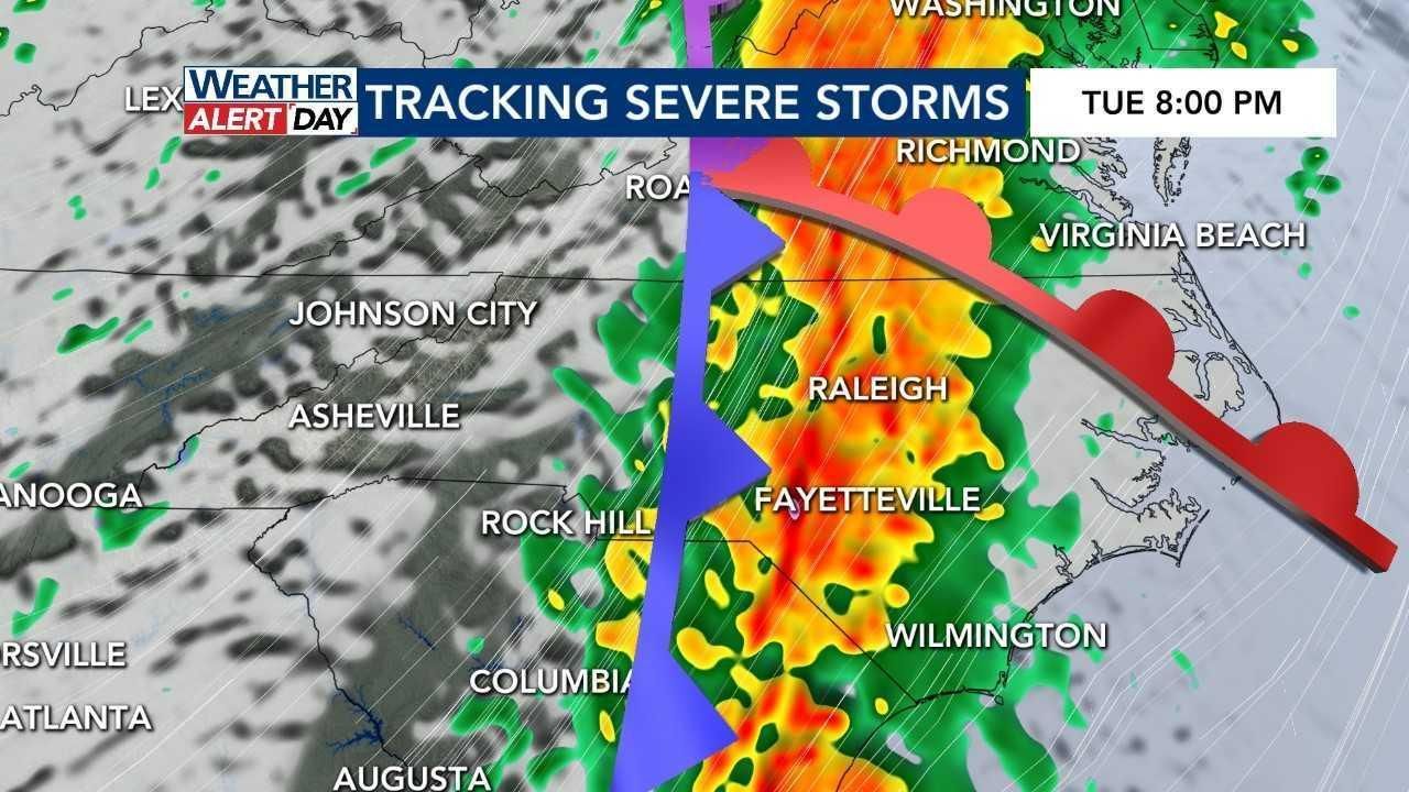
— Severe storms capable of producing tornadoes “are expected” across the Gulf Coast late Monday and from Florida to the Carolinas on Tuesday, forecasters with the Storm Prediction Center said.
— There is a moderate risk of excessive rainfall in the central Gulf Coast later Monday as rain pushes into the region and over parts of the northern Mid-Atlantic on Tuesday. Rainfall of up to 4 inches may cause flash flooding, weather service forecasters said Sunday.
— The next storm system to sweep the country was dropping rain and snow in the Northwest on Monday, with the precipitation forecast to gradually get worse. Flooding rains and blizzard conditions will last through Wednesday morning.

The Plains face blizzards.
Blizzard warnings have been issued for parts of the Central and Southern High Plains through early Tuesday.
In Cimarron County, Oklahoma, emergency management issued a civil emergency Monday afternoon, asking residents to shelter in place because of blizzard conditions. All roads in and out of the county were closed.
The blizzard was expected to wallop portions of Colorado, Kansas, Nebraska, New Mexico, Oklahoma and Texas. Wind gusts of up to and in some cases exceeding 70 mph will create “ferocious blizzard conditions with whiteouts,” forecasters said on Monday.
Wind gusts of over 70 mph were reported in Texas and Oklahoma on Monday afternoon.
The snow is expected to make travel extremely dangerous, if not impossible, and weather watchers suggested that anyone traveling carry a winter survival kit, as wind chills will fall below zero.
The Midwest could get up to 1 foot of snow in certain areas, forecasters said.
“A variety of hazards are anticipated with this next storm system,” Carbin said, adding that power failures were likely because of strong winds and heavy snow. “Travel may be impossible in some parts of the central U.S. as we go into the week.”
The weather service said that the storm was expected to move over the middle Mississippi Valley to the upper Great Lakes on Tuesday evening.
Heavy rains and flooding are likely in the Northeast.
Widespread rainfall of 2 to 4 inches is expected Tuesday throughout the Northeast.
Melting snow from a weekend winter storm that brought 1 foot or more of snow to some parts of the East Coast could contribute to the runoff and increase the risk of flooding, meteorologists said.
“The associated heavy rain will create numerous areas of flash flooding,” the weather service said. “Furthermore, many streams may flood, potentially affecting larger rivers.”
Forecasters identified a large area around Philadelphia where significant river flooding is likely. In total, weather experts are predicting at least 19 rivers in the mid-Atlantic region will see flooding.
Flooding is also possible from as far south as Richmond, Virginia, to as far north as the Catskills in New York, according to forecasters.
There’s a risk of tornadoes in the Gulf Coast.
In the Gulf Coast, there is an enhanced risk of severe thunderstorms Monday night into Tuesday morning, with frequent lightning, powerful wind gusts, hail and a few tornadoes, according to the weather service.
The threat then moves east, bringing with it the risk of tornadoes from Florida to the Carolinas on Tuesday.
But it is not just tornadoes that forecasters are worried about.
Widespread wind gusts in excess of 50 mph are likely in the eastern Gulf Coast, Central Appalachians and much of the East Coast and New England, forecasters said. They warned residents to be prepared for power failures.
Rain and snow will fall in the Pacific Northwest.
Even before the East Coast storm can exit the country, the next storm will already be causing hazardous weather in the Northwest. Rain and snow are expected to fall in the Seattle area on Monday and Tuesday, according to the weather service.
The weather service posted winter storm warnings and its first blizzard warnings in more than 10 years for the Olympic and Cascade Mountains above 2,000 feet. For areas in the blizzard warning, the forecast called for snow accumulation of up to 40 inches and winds gusting as high as 60 mph.
Referring to the storm system in the Pacific Northwest, Carbin said, “It’s a bit uncertain, but this storm does appear to bring rain and wind to the East Coast, and possibly snow inland” by the weekend.
This article originally appeared in The New York Times.


